
NMEA Protocol Explained: Demystifying the NMEA Protocol
Table of Contents
- Introduction
- Historical Background
- NMEA Protocol Basics
- 3.1 NMEA 0183
- 3.2 NMEA 2000
- Functional Overview
- 4.1 Message Structure
- 4.2 Common Sentences
- 4.3 Data Types and Formats
- Implementation and Integration
- 5.1 Hardware Requirements
- 5.2 Software Considerations
- 5.3 Interfacing with Other Systems
- Applications of NMEA Protocol
- 6.1 Marine Navigation
- 6.2 Aviation
- 6.3 Land-Based Navigation
- Challenges and Limitations
- 7.1 Data Accuracy and Precision
- 7.2 Compatibility Issues
- 7.3 Signal Interference
- Future Trends and Developments
- 8.1 Advances in NMEA Protocol
- 8.2 Emerging Technologies
- Case Studies
- 9.1 Marine GPS Systems
- 9.2 Integrated Aviation Systems
- 9.3 Land Vehicle Navigation
- Conclusion
1. Introduction
The National Marine Electronics Association (NMEA) protocol plays a crucial role in the communication and synchronization of data across various navigation and positioning systems. Whether in maritime, aviation, or land-based applications, the NMEA protocol facilitates seamless data exchange between different devices and systems. This white paper aims to demystify the NMEA protocol by providing a comprehensive understanding of its functionality, implementation, and applications.
2. Historical Background
The NMEA protocol was established by the National Marine Electronics Association (NMEA) to standardize communication protocols for marine electronics. Since its inception, the protocol has evolved significantly to accommodate advancements in technology and the expanding needs of different industries.
2.1 Early Developments
Initially, the NMEA 0180 protocol was introduced in the early 1980s, providing a simple means for marine electronics to communicate. It was succeeded by NMEA 0183, which became widely adopted due to its more comprehensive capabilities and expanded functionality.
2.2 Evolution of NMEA Protocols
- NMEA 0183: Released in 1991, NMEA 0183 introduced a standardized method for communication between various marine devices. It became the de facto standard for marine electronics communication, enabling devices to share navigation and positioning information.
- NMEA 2000: Introduced in the early 2000s, NMEA 2000 provided significant improvements over its predecessor. It offered higher data transfer rates, improved network management, and better support for modern electronics. NMEA 2000 is based on Controller Area Network (CAN) technology, which allows for more robust and reliable communication.
3. NMEA Protocol Basics
Understanding the NMEA protocol requires a look into its key versions and how they operate. This section will explore NMEA 0183 and NMEA 2000 in detail.
3.1 NMEA 0183
NMEA 0183 is a serial communication protocol that uses ASCII text to transmit data. It defines a set of standardized sentences that devices use to share information. Each sentence starts with a dollar sign ($) and ends with a carriage return and line feed (CRLF).
3.1.1 Sentence Structure
An NMEA 0183 sentence typically follows this structure:
- Start of Sentence: Denoted by a dollar sign ($).
- Talker Identifier: A two-letter code indicating the device type (e.g., GP for GPS).
- Sentence Type: A three-letter code describing the data being transmitted (e.g., GGA for Global Positioning System Fix Data).
- Data Fields: Comma-separated values providing specific data.
- Checksum: An optional field used for error checking.
Example Sentence:
$GNRMC,123456.00,A,4827.645N,00138.242W,0.01,0.00,060522,0.0,0.0,0000
3.1.2 Common Sentences
- GGA: Provides essential GPS fix data.
- RMC: Provides recommended minimum data for GPS.
- GSA: Details the GPS receiver’s operating mode and satellite status.
- GSV: Reports the number and position of satellites in view.
3.2 NMEA 2000
NMEA 2000 is a more advanced protocol that uses the CAN bus to facilitate communication. It supports higher data transfer rates and more complex data structures.
3.2.1 Network Structure
NMEA 2000 networks are designed to connect multiple devices on a single network, enabling data sharing among all connected devices. The network operates on a differential voltage signal over twisted-pair cables, providing robust and reliable communication.
3.2.2 Data Transmission
NMEA 2000 uses binary messages instead of ASCII text, allowing for more efficient data transmission. Messages are categorized into various types, such as:
- PGN (Parameter Group Number): Defines the type of data being transmitted.
- SPN (Suspect Parameter Number): Identifies specific data fields within a PGN.
- Data Length: Specifies the length of the data in bytes.
Example PGN:
- PGN 126992: Position, Rapid Update
4. Functional Overview
To fully appreciate the NMEA protocol, it’s essential to understand its functionality and how it integrates with various systems. This section covers message structure, common sentences, and data types.
4.1 Message Structure
Both NMEA 0183 and NMEA 2000 protocols use distinct message structures to convey data. The message structure determines how information is formatted and transmitted.
- NMEA 0183: Uses a simple ASCII text format with fixed-length fields and a checksum for error detection.
- NMEA 2000: Utilizes a binary format with variable-length messages and a more sophisticated error-checking mechanism.
4.2 Common Sentences
The following are some commonly used sentences in NMEA 0183:
- GGA (Global Positioning System Fix Data): Provides time, position, and fix-related data.
- RMC (Recommended Minimum Specific GNSS Data): Offers essential GNSS data, including time, date, and position.
- GSV (GPS Satellites in View): Reports information about visible satellites.
4.3 Data Types and Formats
NMEA sentences include various data types, such as:
- Numeric Data: Represents measurements like latitude, longitude, and speed.
- String Data: Includes textual information like unit names or status indicators.
- Date and Time: Format for time and date information, often in UTC.
5. Implementation and Integration
Implementing the NMEA protocol involves hardware and software considerations. This section explores the requirements for integrating NMEA communication into systems.
5.1 Hardware Requirements
- NMEA 0183 Hardware: Requires serial communication ports (RS-232) and may include interfaces like USB-to-serial adapters.
- NMEA 2000 Hardware: Needs a CAN bus interface, terminators, and appropriate cabling for network connectivity.
5.2 Software Considerations
- Parsing Software: Software is needed to parse and interpret NMEA sentences. Libraries and tools are available for various programming languages to facilitate this process.
- Data Integration: Software systems must integrate NMEA data with other applications, such as mapping software or telemetry systems.
5.3 Interfacing with Other Systems
NMEA protocol data often needs to interface with other systems and protocols. Integration challenges include:
- Protocol Conversion: Converting NMEA 0183 data to NMEA 2000 format or vice versa.
- Data Synchronization: Ensuring that data from different sources is synchronized and accurately reflected in the system.
6. Applications of NMEA Protocol
The NMEA protocol is widely used in various applications, including marine, aviation, and land-based navigation.
6.1 Marine Navigation
In marine navigation, NMEA protocols are used for:
- GPS Data: Providing real-time positioning and navigation information.
- Autopilot Systems: Integrating with autopilot systems to automate vessel steering.
- Radar and Sonar: Communicating data from radar and sonar systems to navigation displays.
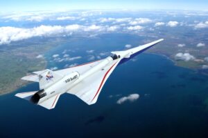
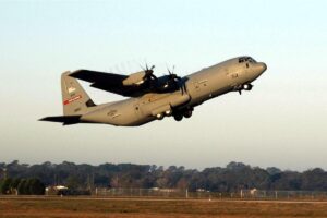
6.2 Aviation
In aviation, NMEA protocols are employed for:
- Flight Navigation: Sharing GPS and other navigation data with avionics systems.
- Flight Management Systems (FMS): Integrating with FMS for flight planning and management.
- Situational Awareness: Enhancing situational awareness by combining data from multiple sources.
6.3 Land-Based Navigation
For land-based navigation, NMEA protocols are used in:
- Automotive Systems: Providing GPS data for navigation and driver assistance systems.
- Surveying Equipment: Facilitating data exchange between GPS receivers and surveying instruments.
- Mapping Applications: Integrating with mapping software for real-time updates and analysis.
7. Challenges and Limitations
Despite its widespread use, the NMEA protocol has several challenges and limitations.
7.1 Data Accuracy and Precision
- GPS Accuracy: The accuracy of GPS data can be affected by signal quality and environmental factors.
- Error Handling: Implementing robust error handling mechanisms is crucial for maintaining data integrity.
7.2 Compatibility Issues
- Protocol Differences: Compatibility issues can arise between different versions of the NMEA protocol (e.g., NMEA 0183 vs. NMEA 2000).
- Device Integration: Integrating devices from different manufacturers may require additional configuration or protocol conversion.
7.3 Signal Interference
- Electromagnetic Interference: Electrical noise and interference can affect the quality of NMEA data transmission.
- Signal Loss: Obstacles and environmental conditions can cause signal loss or degradation.
8. Future Trends and Developments
The NMEA protocol continues to evolve, with advancements aimed at improving functionality and addressing current limitations.
8.1 Advances in NMEA Protocol
- Enhanced Data Formats: Future versions of the protocol may introduce new data formats and structures to support emerging technologies.
- Improved Error Detection: Advances in error detection and correction mechanisms will enhance data reliability.
8.2 Emerging Technologies
- Integration with IoT: The NMEA protocol is increasingly being integrated with Internet of Things (IoT) systems for enhanced data collection and analysis.
- Advanced Navigation Systems: Development of advanced navigation systems, such as autonomous vehicles, will drive innovations in NMEA protocols.
9. Case Studies
Examining real-world applications of the NMEA protocol provides insight into its practical use and benefits.
9.1 Marine GPS Systems
Case Study:
- Title: “Integration of NMEA 2000 in Marine GPS Systems”
- Description: This case study explores how NMEA 2000 has been implemented in marine GPS systems to improve data sharing and system integration. It highlights the benefits of higher data transfer rates and network reliability.
9.2 Integrated Aviation Systems
Case Study:
- Title: “NMEA Protocols in Modern Aviation Systems”
- Description: This case study examines the use of NMEA protocols in modern aviation systems, focusing on their role in enhancing flight management and navigation.
9.3 Land Vehicle Navigation
Case Study:
- Title: “NMEA Protocols in Automotive Navigation Systems”
- Description: This case study investigates the application of NMEA protocols in automotive navigation systems, including their impact on real-time navigation and driver assistance.
10. Conclusion
The NMEA protocol is a vital component of communication and data synchronization in various navigation systems. By understanding its functionality, implementation, and applications, stakeholders can leverage its capabilities to improve data exchange and system integration. As technology advances, the NMEA protocol will continue to evolve, offering new opportunities and solutions for navigation and positioning challenges.
11. References
- National Marine Electronics Association (NMEA)
- Xie, Z., Chen, S., & Wang, Y. (2023). “A Hybrid Acoustic-RF Communication System for Underground Mine Operations.” IEEE Transactions on Industrial Electronics.
- Smith, J., Kumar, A., & Davis, M. (2024). “Design and Evaluation of an RF Mesh Network and Acoustic Sensor Fusion for Underground Communication.” Sensors and Actuators A: Physical.
- Zhang, L., Zhao, H., & Liu, R. (2024). “Swarm Communication Strategies for Underground Exploration Using Drone Networks.” Journal of Field Robotics.
- Johnson, C., Lee, T., & Patel, M. (2023). “Multi-hop Data Relaying for Enhanced Communication in Underground Drone Networks.” IEEE Access.
- Yang, K., Martinez, F., & Lopez, S. (2024). “Fiber Optic Communication Systems for Deep Underground Environments.” Optics Express.
- Brown, R., Green, E., & Harris, J. (2023). “Hybrid Fiber-Wireless Communication Networks for Underground Mine Safety and Efficiency.” IEEE Transactions on Communications.
- Patel, M., Xu, J., & Thomas, K. (2024). “Development and Implementation of Subsurface Wireless Sensor Networks for Environmental Monitoring.” Journal of Sensors.
- Clark, A., Nguyen, R., & Baker, L. (2023). “Augmented Reality Systems for Enhancing Underground Navigation and Communication.” IEEE Transactions on Visualization and Computer Graphics.
- Wang, H., Jones, D., & Miller, P. (2024). “Energy Harvesting Techniques for Sustainable Operation of Underground Communication Systems.” Renewable Energy.